Objective
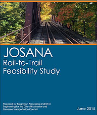
This is a concept-level planning study that seeks to develop a conceptual trail layout and improvement plan, with an exploration of alternatives, and corresponding estimates for a rail-to-trail conversion. It will also investigate connections within the Charles JOSANA, Brown's Square, and High Falls neighborhoods of the City of Rochester.
Read the Final Study here
The City hopes for the opportunity to seek funding for a final design, property acquisition, and construction of the preferred trail and relevant linkage to the Genesee Riverway Trail.
This project was funded in the most part with federal planning funds from the Genesee Transportation Council’s (GTC) Unified Work Program (Task #6526).
Background
The Rochester region has a long and proud history of trail development for economic, transportation and recreational purposes. The City of Rochester has played a key role in this development with the Genesee Riverway Trail. The City has leveraged local, state and federal resources to develop the 26-mile long trail spanning the length of the Genesee River as it passes through the City from south to north. The Genesee Riverway Trail (GRT) is a designated National Recreation Trail, a backbone of the GTC Regional Trails Initiative and the City’s LWRP, and an established regional asset that connects a vast array of recreational, historical and cultural attractions, diverse neighborhoods and the Seaway Trail, Erie Canal Heritage Trail, Genesee Valley Greenway Trail, Lake Ontario State Parkway Trail, Irondequoit Lakeside Trail, El Camino Trail and, the Highland/Canalway Trail (in design).
With the majority of the trail in place, the City is continually looking to improve upon existing sections of the Genesee Riverway Trail, fill gaps in connectivity, and provide linkages to other trails, neighborhoods, business centers and attractions. This project presents the opportunity to do all of the above.
The proposed JOSANA Trail will establish an east/west connection between the City’s Genesee Riverway & Trail at High Falls to the Brown’s Square and the JOSANA neighborhoods.
This project is directly related to two recently completed City plans/studies, the JOSANA Neighborhood Master Plan (2010) and the UPWP-funded Brown's Square - Circulation, Accessibility, & Parking Study (2010). This rails-to-trail conversion project is a direct recommendation of the JOSANA Master Plan and while not specifically referenced in the Brown's Square study, it supports the study's general bicycle/pedestrian recommendations. The project is also consistent with the Lyell-Lake-State (LYLAKS) Brownfield Opportunity Area (BOA) Nomination Study.
In addition, the 2011 City of Rochester Bicycle Master Plan identified a significant hot-spot of incidents along the Lyell Avenue corridor between Murray Street and Dewey Avenue, parallel and directly north of the proposed rails-to-trails conversion. This trail would provide a safe transportation alternative directly adjacent to the Lyell Avenue corridor.
The City has recently learned that CSX may be preparing to abandon a section of inactive rail line between Oak Street and Hague Street, running south of and parallel to Lyell Avenue. Should this study provide a feasible trail alternative, and with neighborhood support, the City would be poised to capitalize on this unique opportunity, when and if it became available. Bergmann Associates is the City’s consultant for this feasibility study.
Final Study
Feasibility Study - Final - June 2015 
Project Maps
Study Area Boundary Maps - September 2014
Preliminary Concept Sketch - September 2012
Project|Meeting Documents
Public Meeting Notice (October 3, 2014)
Public Meeting #1 - Meeting Notes
Public Meeting #1 - Presentation
Public Meeting #2 - Meeting Notes
Public Meeting #2 - Presentation